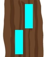
Main Trail - White Blaze
Main Trail - White Blaze
Main Trail - White Blaze
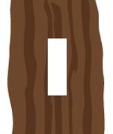
Straight ahead hiking path
Left Turn
Main Trail - White Blaze
Main Trail - White Blaze
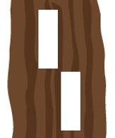
Noteworthy direction change
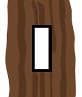
Tuxedo Blaze
Main Trail - White Blaze
Side Trail - Blue Blaze
Emphasize blaze
Side Trail - Blue Blaze
Side Trail - Blue Blaze
Side Trail - Blue Blaze
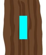
Straight ahead hiking path
Right Turn
Side Trail - Blue Blaze
End Of Side Trail
Noteworthy direction change
End Of Side Trail
Side Trail - Blue Blaze
End Of Side Trail
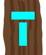
Dead end or reconnects
with Main Trail
Ausable River Cut Conservation Area

Description
Owned by the Ausable Bayfield Conservation Authority, this 32-acre roadside park offers a pleasant 1.5 km hiking loop trail through Carolinian forest, over sand dunes and along the Ausable River Cut.
Additional Notes
A 550 m wheelchair accessible loop includes a viewing platform overlooking the Ausable River Cut. A children's Story Walk follows the accessible path.
As well as a “wind phone” (a grief tool that to support connections with loved ones who have passed) is located in a private grove just off the main trail.
The AusableRiver Cut CA is a great place to fish for catfish, drum, perch and pickerel.
Status
Fully blazed with trailhead map and signs.
A gravel parking lot and washroom (pit toilet) are available.
Difficulty & Distance
Easy to Moderate - 1.5 km loop
Access
9984 Northville Cres. just off Hwy # 21 at the Ausable Cut Bridge in Northville.
Ausable River Valley & Mystery Falls
Description
Owned by the Ausable Bayfield Conservation Authority, this large property offers two distinct trails through the rugged landscape of the Ausable River Valley:
Mystery Falls Loop Trail (blazed white and blue) - This loop connects with the greater Ausable River Valley trail system. From the parking lot (Elm Tree Drive), the direct route to the falls is 1 km. The entire Mystery Falls loop trail is 3.5 km through hilly Carolinian forest.
Ausable River Valley Trail (blazed white) - This demanding +6 km trail follows the winding Ausable River, with many steep slopes, ravines and gullies. It offers several side trails and connects to the Mystery Falls Loop in the south. You can enter the trail from the north (MacDonald Drive) or south (Elm Tree Drive).
Additional Notes
This trail network is EXTREMELY CHALLENGING, with steep ravines and narrow passage in some areas. Slopes and hollows can be muddy and slippery, especially in the spring and fall. Proper footwear is a MUST - casual shoes or flipflops are not recommended!
Be aware that hunting is permitted on this property and adjacent landowners are hunters.
STAY ON THE MARKED TRAILS - DO NOT TRESPASS!
Status
Fully blazed with 8 map kiosks throughout.
Limited parking is available at both access points (gravel lot).
A portable washroom is available at the Elm Tree parking lot.
Difficulty & Distance
Mystery Falls Loop Trail - Moderate to Difficult - 3.5 km
Ausable River Valley Trail - Difficult to Extremely Difficult - +6 km (one direction)
Access
Trails are accessible from two points: the west end of Elm Tree Drive (for Mystery Falls and south Ausable River Valley) and the west end of MacDonald Drive (north end of Ausable River Valley) in North Middlesex.
Parking, especially at MacDonald Drive, is limited. DO NOT PARK ON THE ROADWAY or IN ADJACENT FIELDS!
PLEASE NOTE: Elm Tree Drive and MacDonald Drive are gravel roads that are NOT MAINTAINED in winter, and may be in poor condition during early spring or late fall. If you get stuck, your roadside assistance provider will most certainly charge you for the tow.
Elm Tree Drive: https://w3w.co/annotated.tunes.lamest
MacDonald Drive: https://w3w.co/headphone.sushi.veterinary
Forest Trails

Description
Owned by the Municipality of Lambton Shores, the paved multi-use Forest Walkway Trail leads south from the trailhead to the Esli Dodge Conservation Area. The Grand Trunk Trail, an accessible chip and dust pedestrian pathway, follows the old railway bed from the trailhead to Brush Line Road. At the west end of the Grand Trunk Trail, walkers can access the short Lagoon Loop where a viewing platform offers a panorama of this wetland environment,.
Additional Notes
Improvements to the Grand Trunk Trail include several structures and plaques relating to the history of the railroad in Forest. As well, benches along the rail trail provide regular rest stops.
A skateboard (X-Park) is available at the trailhead. A short trail to the east leads to the Rotary Civic Square which offers a splash pad.
Status
Trailhead structure & signs.
Limited parking at the Grand Trunk Trailhead.
Difficulty & Distance
Forest Walkway - Easy - 2.8 km out and back
Grand Trunk Trail - Easy - 4 km out and back
Lagoon Loop - Easy - 1.8 km loop
Access
Trailhead is located at 12 Railroad Way, Forest.
*Forested Dunes Nature Reserve
Description
Owned by Nature Conservancy of Canada, the Forested Dunes trail leads through the the 139-acre Forested Dunes Nature Reserve. It is part of the 150,000-acre Port Franks Dunes & Wetlands Complex which has been designated as an Area of Natural & Scientific Interest (ANSI) and Important Birding Area (IBA). The trail is accessed via the L Lake Loop Trail.
Additional Notes
The trail is open but has not been maintained for a number of years.
PLEASE BE AWARE that this property is renowned for having TICKS.
Status
THIS TRAIL IS NOT MAINTAINED.
Difficulty & Distance
Easy - 4 km out and back
Access
7101 Outer Drive west of Port Franks through the ‘L’ Lake Management Area owned by the Ausable-Bayfield Conservation Authority.
*Grand Bend Rotary Nature Trail
Description
This 9 km paved multi-use trail runs parallel to Highway #21 from Grand Bend to the entrance of Pinery Provinial Park. It is generally flat but has a few hills in the south section. Recent additions of bike lanes on Highway 21 allow cyclists to continue past the Pinery to the Ausable River Cut bridge.
Additional Notes
A few benches offer rest stops.
Status
Developed hard-surfaced multi-use trail.
Difficulty & Distance
Easy - 9 km one direction
Access
Anywhere along Highway 21 from the entrance of Pinery Provincial Park and Grand Bend.
https://w3w.co/available.arrangement.paddlers or https://w3w.co/fluids.contoured.lozenges
*Heritage-Ausable Connector
Description
This connector trail passes through lands owned by the Nature Conservancy of Canada, Lambton County and the Oakridge Family Campground. The 2 km trail connects the Ausable River Cut trail network to the Karner BlueTrail (off Port Franks Road) and the Lambton County Heritage Forest trails in Port Franks.
Additional Notes
A portion of the connector is along a paved shoulder of the Port Franks Road.
Status
Blazed orange with on-trail directional signs.
Difficulty & Distance
Easy - 2 km one direction
Access
9997 Port Franks Road at the Port Franks Community Centre parking lot Trailhead OR at the back of the 'white' blazed trail loop in the Ausable River Cut Conservation Area.
https://w3w.co/glug.handicaps.rejections or https://w3w.co/downswing.airbase.aspects
*Ipperwash Dunes & Swales
Description
Owned by Nature Conservancy of Canada, the Carolinian Forest & Dunelands here covers over 500 acres and includes a 172-acre Nature Reserve. The Dunes & Swales Trail (blazed white) winds through a Carolinian forest of sand ridges and wet swales passable on boardwalks. A variety of wildflowers makes this trail a feast for the eyes in spring. The Cedar Trail (blazed green) features many cedar coves.
Additional Notes
These trails have many mosquitoes during the summer months.
Status
Fully blazed with trailhead map and signs.
Limited parking available (gravel lot).
Difficulty & Distance
Dunes & Swales Trail - Easy - 4 km out and back
Cedar Trail - Easy - 1.5 km out and back
Access
In Ipperwash from the end of Richardson Drive off East Parkway Drive.
*Joany's Woods - Temporarily CLOSed
Description
Owned by the Thames Talbot Land Trust, the 367 acre property located in the Ausable River Valley (just north of the bridge on County Road #7) has two trail loops, one through mixed Carolinian-Great Lakes Hardwood Swamp Forest, and one through forest and along the Ausable River. Visit www.thamestalbotlandtrust.ca
Additional Notes
The trails have mosquitoes during the summer months.
Status
Developed trails - trailhead and on-trail signs installed and trail guide available.
Parking available - see website.
Difficulty & Distance
Ivey Trail - Easy to Moderate - 5.1 km loop
Inch Trail - Moderate - 3.7 km loop
Access
Boothill Road from north & Vernon Road from south near Village of Sylvan on County Road #7.
*Karner Blue
Description
Owned by Lambton Wildlife, this extremely rare 37-acre Dry Oak-Pine Woodland has a 2 km trail traversing it on a gently sloping sandy terrain. The Karner Blue butterfly after which this Nature Sanctuary is named is extirpated.
Additional Notes
This trail is overgrown with poison ivy.
Status
Blazed & accessible hiking trail loop - no trailhead or on-trail signs.
Difficulty & Distance
Easy - 1.6 km loop
Access
9904 Nipigon Street in Port Franks - 0.5 km east of Port Franks Road at Whatman Street.
'L' Lake Management Area
Description
Owned by the Ausable Bayfield Conservation Authority, the 69 acre ‘L’ Lake site offers a gentle 1.5 km hiking trail through cedar wetlands and mixed Carolinian Forest. This is also the entrance to the Nature Conservancy of Canada's Forested Dunes Nature Reserve.
Additional Notes
This trail has many mosquitoes during the summer months.
Status
Fully blazed with trailhead map and sign.
Limited parking available on widened shoulder of Outer Drive.
Difficulty & Distance
Easy - 1.5 km loop
Access
7101 Outer Drive west of Port Franks
*Lambton County Heritage Forest
Description
Owned by the County of Lambton, and managed by the St. Clair Region Conservation Authority, this 570-acre Oak-Savanna & Carolinian Forest offers three interconnected trails totalling 8 km. All are accessed from the Port Franks Community Centre.
Additional Notes
Welcome to the 'Heart of the Trails' where more than 18 km of trails can be found within a 4 km radius on 5 separate properties, many of which are connected. The showcase trailhead and adjacent "Circle of Life" features indigenous artwork, native plants, and carved animals. A 550 m-long wheelchair accessible path through a "tree tunnel" can be found behind the community centre with over 100 trees and a children's StoryWalk.
Status
Fully blazed with trailhead map and on-trail directional signs.
Difficulty & Distance
Tulip Trail - Easy to Moderate - 3.1 km
High Ridge Trail - Moderate to Difficult - 2.8 km
Savannah Trail - Moderate - 2.1 km
Access
9997 Port Franks Road at the Port Franks Community Centre in Port Franks.
*Lambton Heritage Museum
Description
Owned by the County of Lambton, the Woodland Heritage Trail is a loop through the forest around the museum. The trail is accessible year round and, in the winter, snowshoes are available for rent for adults and children (over 60 pounds).
Additional Notes
The trail is included as part of your regular museum admission fee. Visit www.lambtonmuseums.ca/lambton-heritage-museum/ for more details.
Status
Gravel & woodchip walking/hiking trail loop. Planned on-trail signs to include a series of interpretive panels and a StoryWalk.
Difficulty & Distance
Easy - 1 km loop
Access
10035 Museum Road, Grand Bend (just north of the Pinery Provincial Park entrance off Hwy. 21)
*Pinery Provincial Park
Description
Owned by the Province of Ontario, this large 6300-acre park has kilometers of sandy beaches and an extensive network of hiking and bicycle trails through Oak Savannah. During the winter, some trails are designatd and groomed for cross country skiing.
Additional Notes
An entrance fee applies. Visit www.pinerypark.on.ca for more details.
Status
Developed hiking and bicycle trails - trailhead signs installed.
Parking and washrooms available.
Difficulty & Distance
A variety of trails - Easy - various distances
Access
1512 Lakeshore Drive (Hwy #21) 10 km south of Grand Bend.
*Rock Glen Conservation Area

Description
Owned by the Ausable Bayfield Conservation Authority, this 67-acre gorge site has several short hiking trails through Carolinian Forest, some with steep stairways. There is a wheelchair accessible overlook. You are welcome and encouraged to visit the Arkona Lions Museum and Information Centre to learn more about the rich history of the area.
Additional Notes
Status
Developed Trail System - trailhead signs and markers installed.
Difficulty & Distance
A variety of short, interconnected trails - Easy to Moderate - various distances
Access
8680 Rock Glen Road - Follow the Conservation Area sign from County Road #79 just north of Arkona.